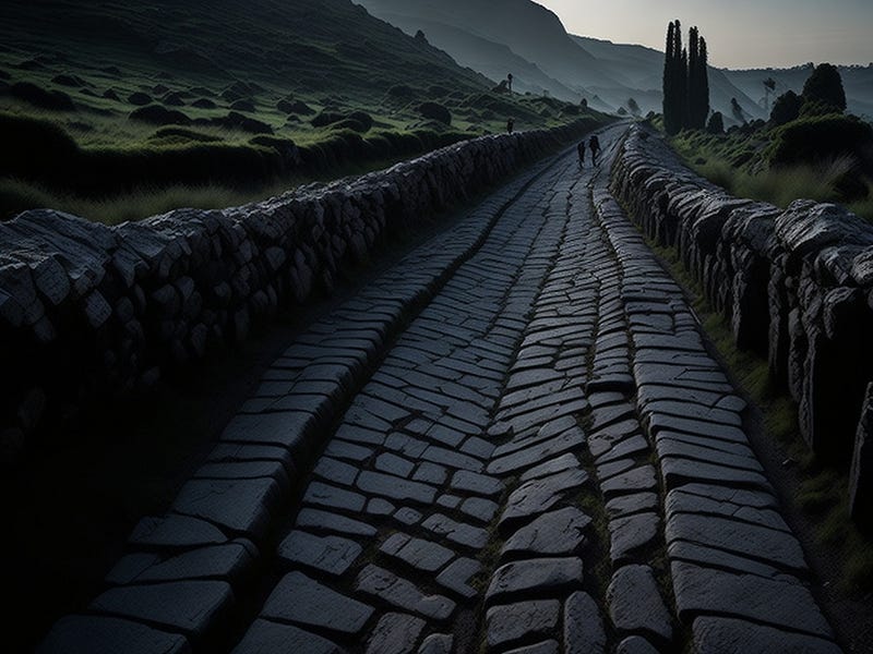
Unveiling the Hidden Roman Road Network in Britain
Written on
Chapter 1: The Discovery of Roman Roads
A remarkable breakthrough in the field of archaeology has emerged in recent years through the application of airborne laser scanning technology. This advanced method has led to the identification of a previously unknown network of Roman roads across Great Britain. These routes were meticulously constructed and utilized extensively during the Roman occupation.

One of the most significant advancements in archaeology has been the introduction of airborne laser scanning. This technique, known as LIDAR (Light Detection and Ranging), involves sending laser pulses from an aircraft or drone towards the Earth's surface. When these pulses encounter obstacles, they bounce back, and the time taken for the echoes to return is measured. This method is considered groundbreaking as it provides an exceptionally precise analysis of terrain, enabling the discovery of subtle traces of ancient structures. Initially, such technology was primarily employed for military applications.
This innovative technique has proven useful not just for identifying ancient burial sites but also for uncovering ancient roadways. This was demonstrated by British researchers in a study published in the “Journal of Computer Applications in Archaeology.” Their focus was on the southwestern region of Great Britain, specifically west of Exeter, encompassing a significant portion of Devon and Cornwall. They successfully mapped out a network of Roman roads in this area.
Section 1.1: Mapping the Roman Presence in Britain
From the 1st century to the early 5th century AD, the Romans exerted control over vast regions of Britain, including what is now Scotland, referred to as Caledonia during their rule. This period saw the establishment of numerous cities, often based on military encampments, and the construction of extensive road systems. However, the southwestern part of Britain remained largely unexplored in terms of its ancient roadways. Researchers struggled for decades to update historical maps of roads in this region due to a lack of data and appropriate tools.
Between 2016 and 2022, the National LIDAR Programme was initiated, aiming to create a comprehensive laser map of Great Britain. The data produced were made accessible to historians, who began their analyses, ultimately leading to the identification of approximately 100 kilometers of previously uncharted road networks dating back thousands of years.
The first video titled "How to identify a Roman Road by Mike Haken - YouTube" provides insights into the methodologies and criteria for recognizing Roman roads, illustrating the significance of this research.
Section 1.2: Advanced Techniques in Road Mapping
To achieve this discovery, researchers employed a variety of tools, including geographic information system models that helped fill in gaps in the anticipated layout of the road network. Before examining LIDAR imagery, they referenced historical maps to locate known ancient fortifications and settlements, which guided their predictions of potential road routes. Remarkably, in many instances, their expectations were confirmed with the physical presence of the roads.
Subsection 1.2.1: Purpose of Roman Roads
Archaeological evidence suggests that the identified road network may consist of a blend of ancient trails—some dating back to prehistoric times, others established during Roman military campaigns or during peacetime. Researchers propose that these roads were likely constructed to facilitate the movement of wheeled vehicles and to navigate around areas susceptible to flooding.
Chapter 2: Insights from LIDAR Technology
The second video titled "Reinterpreting Roman Roads in the Chilterns - insights from LiDAR by Dr E. Peveler and N. Rothwell - YouTube" explores the implications of LIDAR findings on our understanding of Roman road systems and their historical context.
Unique Discovery in Jerusalem
In a separate archaeological breakthrough, Israeli researchers have uncovered evidence affirming the historical accounts of ancient Jerusalem's destruction by the Babylonian army…
Dear Readers,
I want to address a concern affecting content creators like myself on Medium.com. Despite our dedication to crafting valuable content, compensation often falls short. If you appreciate my work, please consider supporting me on my “Buy Me a Coffee” page. Your contributions, regardless of size, inspire me to keep producing engaging and thought-provoking content. Thank you for being a part of this journey!
